Aerial imagery, construction progress documentation, and recurring
inspection subscriptions for Northeast Ohio — commercial, industrial,
and municipal.
FAA Part 107 certified · Fully insured · Serving Greater Cleveland and Northeast Ohio
Selected work
Aerial work across Northeast Ohio.
A look at recent flights — commercial, industrial, and municipal
sites captured across Greater Cleveland and the surrounding
region.
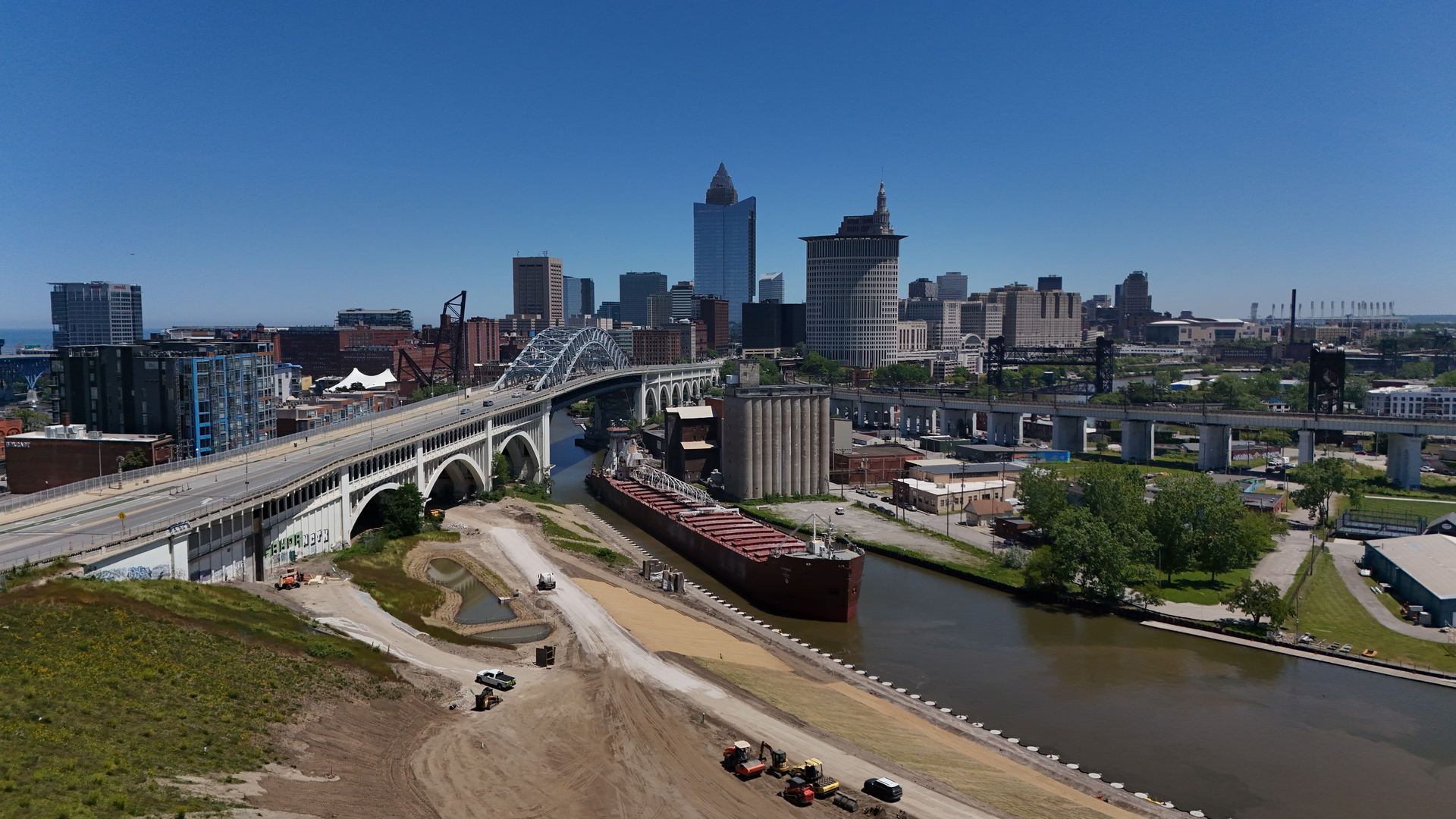
Cleveland skyline and the Cuyahoga River from Irishtown Bend —
Detroit–Superior Bridge with a freighter at the riverfront
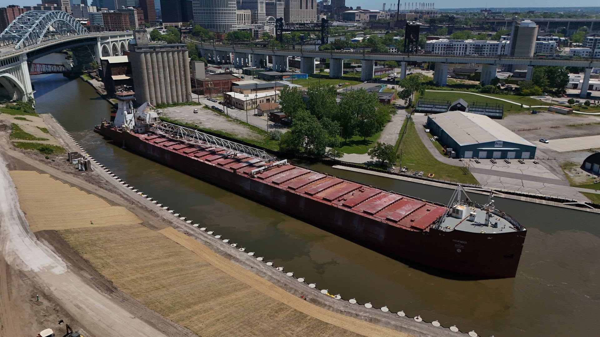
Great Lakes freighter on the Cuyahoga shipping channel
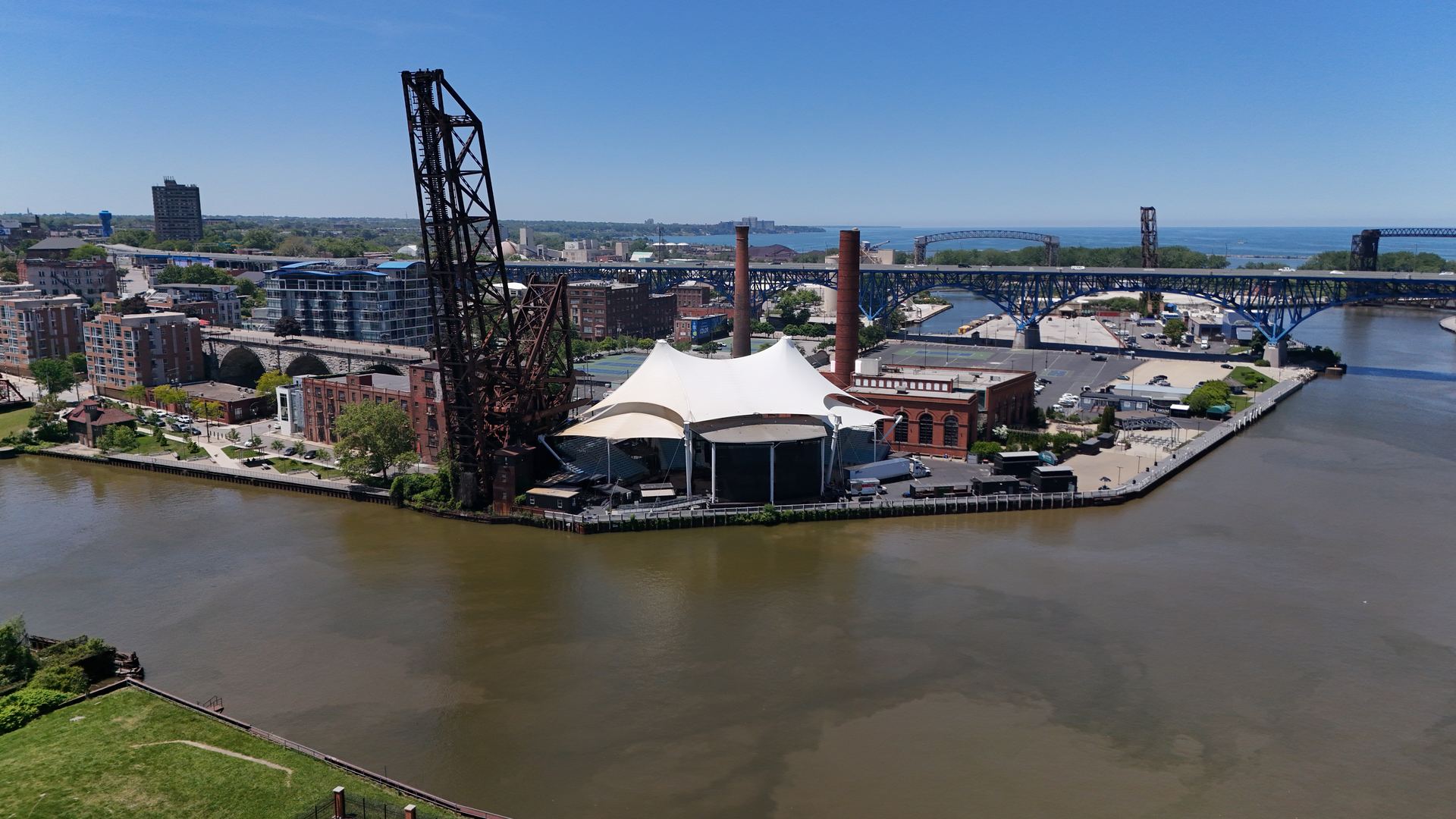
Warehouse District lofts and rail corridor, Lake Erie beyond
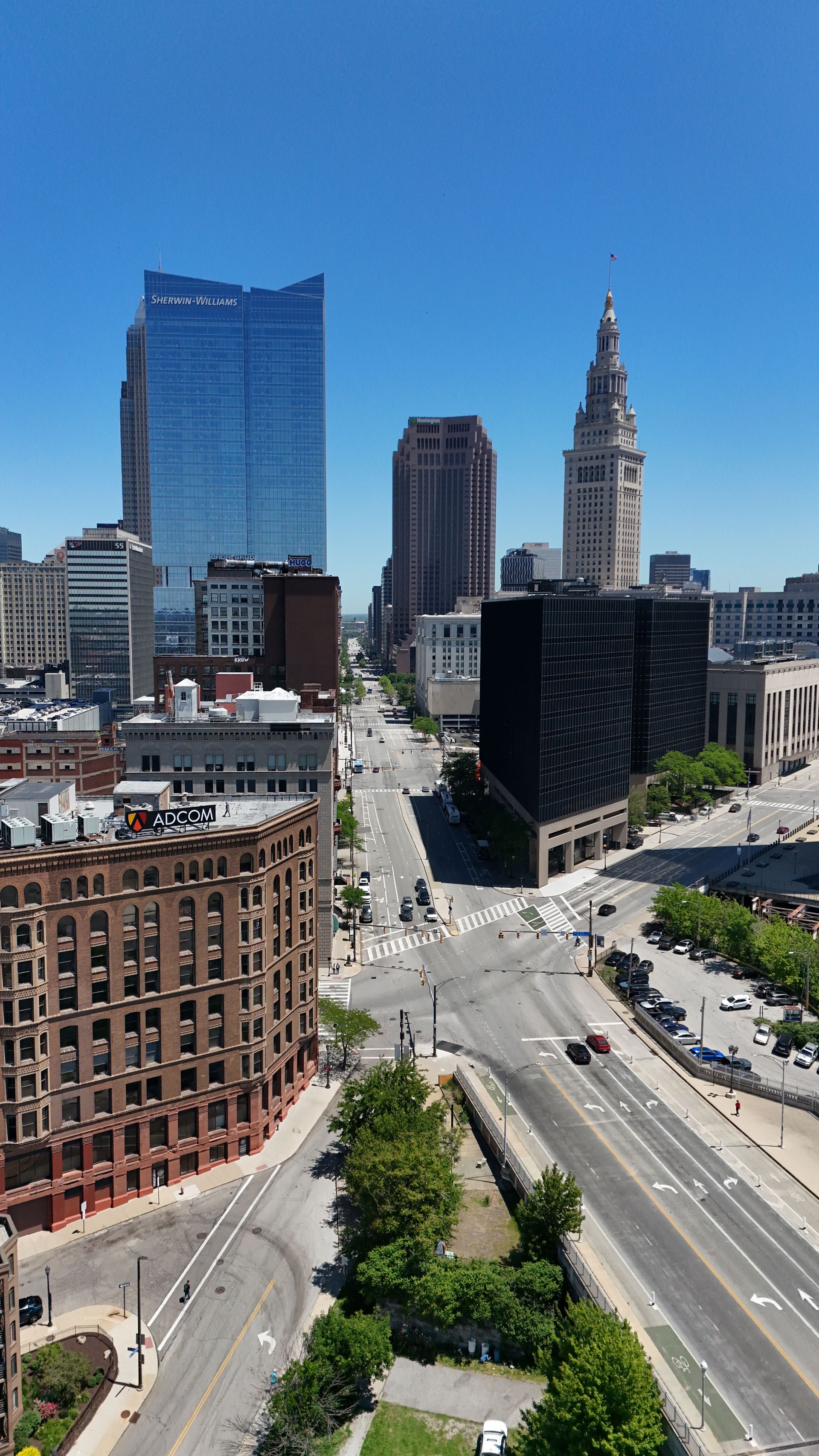
Downtown core — Sherwin-Williams HQ and Terminal Tower
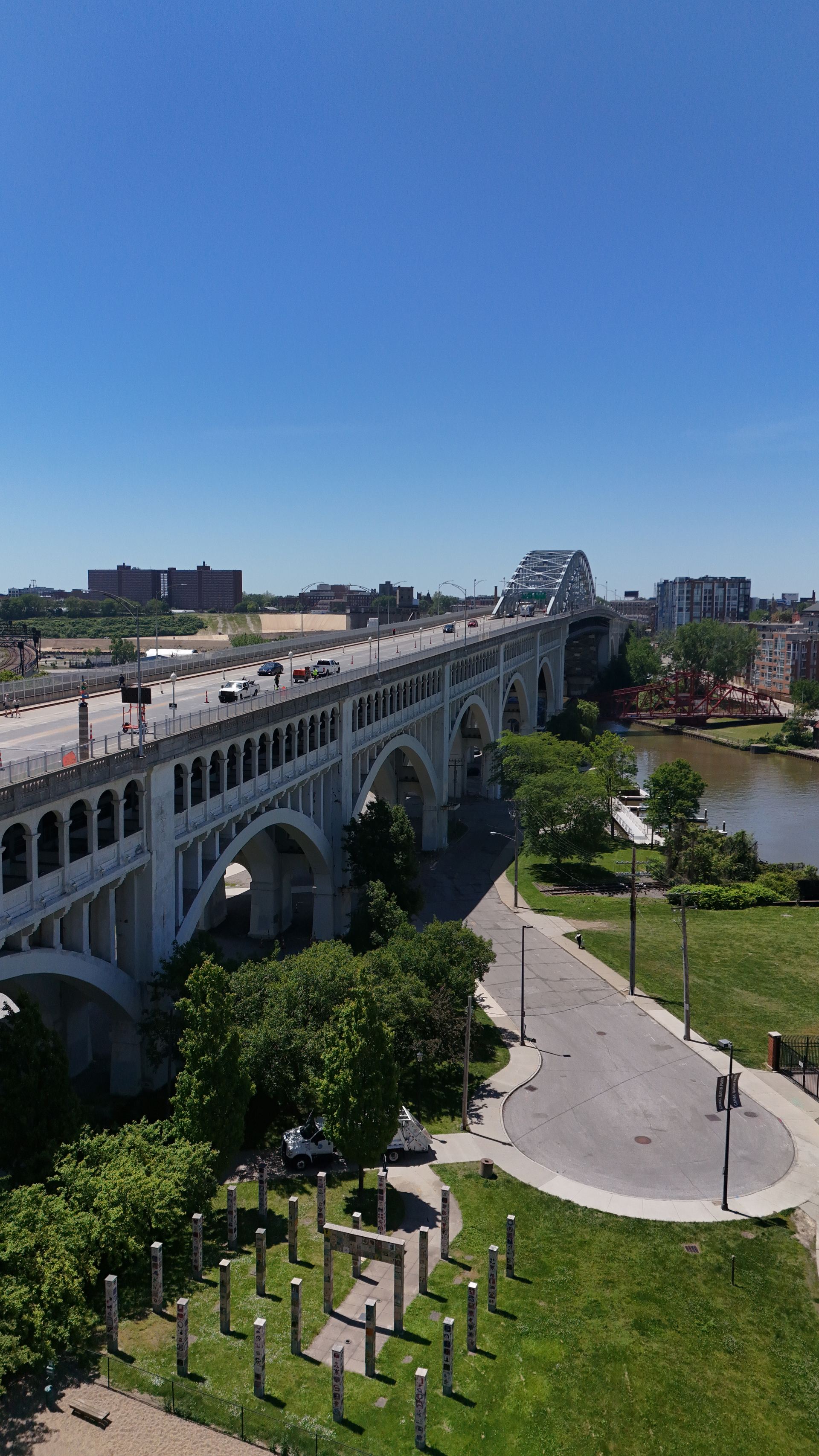
Detroit–Superior Bridge arches over the Cuyahoga — vertical aerial
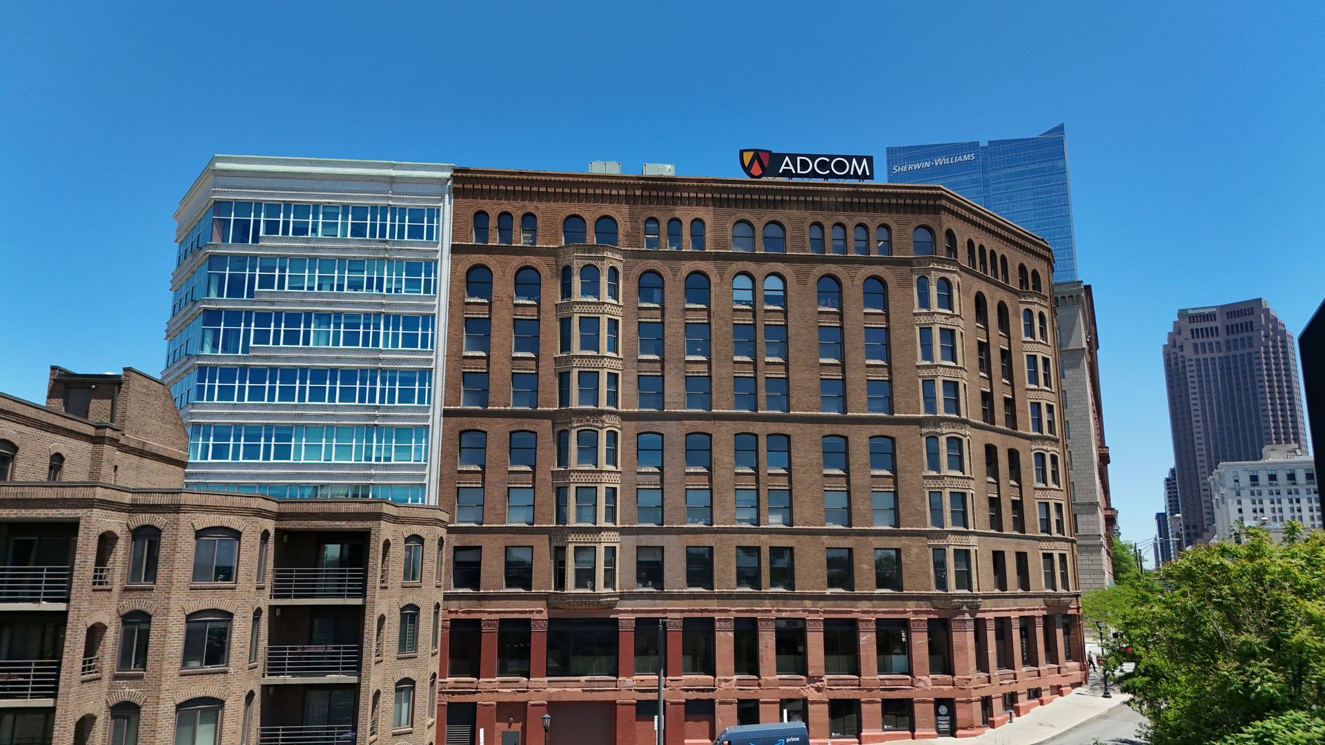
Historic commercial architecture, downtown Cleveland
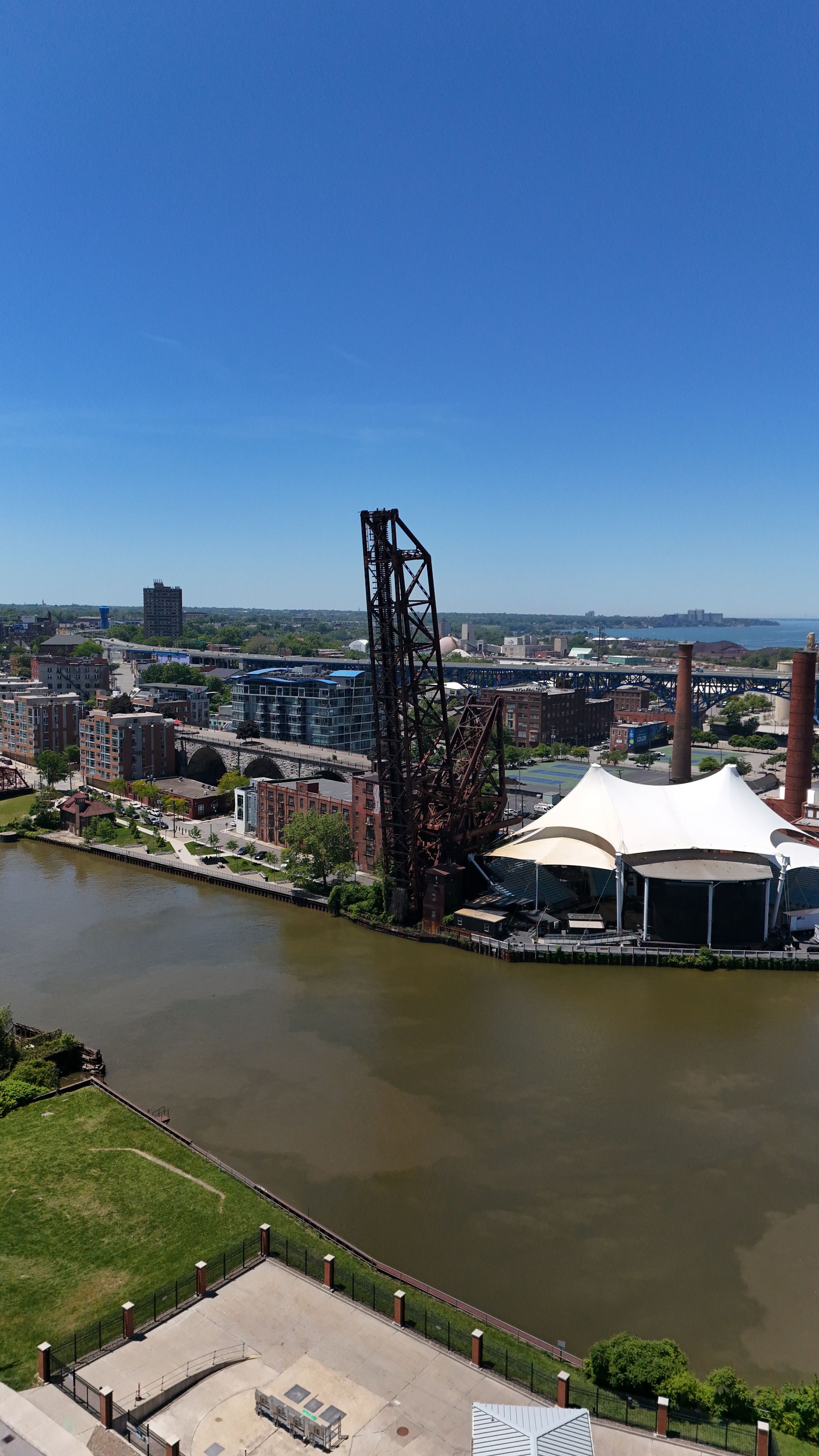
Cuyahoga lift bridge and riverfront pavilion, skyline beyond
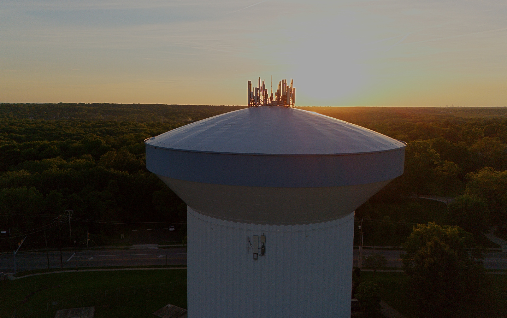
Municipal water tower with cellular antennas, golden hour —
Northeast Ohio
Services
Four ways to work with Stratum.
One lane for straightforward local aerial requests. One lane
built around recurring construction progress documentation. One
lane for commercial real estate owners and teams who need
listing-ready aerial media. And a recurring inspection
subscription for facility teams who need a defensible condition
history. All local. All fast. All built to be easy to share.
Lane 01 — Local
Local Aerial Work
Simple inbound aerial requests across Greater Cleveland and
Northeast Ohio. One-time shoots, clear deliverables, quick
turnaround.
Recurring aerial documentation built for active jobsites.
Repeatable site coverage, 24-hour turnaround, and a dedicated
shareable webpage after every visit.
Listing-ready aerial photos and short clips for Cleveland-area
office, industrial, and retail properties — with basic exterior
documentation of roof, facade, and site context captured in the
same flight.
Show the full context of your property in listings and OM packages
Give owners, investors, and lenders a current visual record of key assets
Capture roof and exterior conditions from the air without mobilizing lifts
Professional, insured operations — not “guy-with-a-drone” risk
Annual and semi-annual drone inspection programs for roofs,
façades, and building envelope. Severity-rated findings and
defensible condition history for NEO facility teams.
A productized aerial progress service for general contractors,
developers, and project teams. Repeatable visits, consistent
viewpoints, and a clean shareable page that keeps owners and
executives in the loop without another meeting.
01
Recurring documentation
Scheduled progress visits on a cadence that fits the build —
weekly, biweekly, monthly, or milestone-based.
02
Repeatable viewpoints
Consistent aerial angles across visits so progress reads
clearly side-by-side from groundwork through completion.
03
Progress visibility
Steady visual updates between site walks and project meetings
so the work is visible to everyone who needs to see it.
04
Easy stakeholder sharing
One link to share with owners, executives, lenders, and
project teams. No logins, no software, no friction.
05
24-hour turnaround
Edited aerial stills delivered within 24 hours of every site
visit so updates stay current with the build.
06
Dedicated project webpage
Each visit produces a clean, well-designed webpage organized
by date — anyone with the private link can review it from
any device, no logins or software required.
How it works
A simple four-step process.
1
Schedule the visit
Set a cadence or a one-time visit that fits the project timeline.
2
Capture the site
On-site aerial coverage of the build using repeatable viewpoints.
3
Receive a shareable webpage
Edited stills and a dedicated project webpage delivered within 24 hours.
4
Repeat as needed
Stay on cadence throughout the project for steady stakeholder updates.
What clients receive
Every visit, the same clean deliverables.
Edited aerial stills, ready to use
Optional short clips when relevant
Organized project visuals, sorted by date
Dedicated shareable project webpage
Easy stakeholder review — one link, no logins
Optional add-ons available where relevant
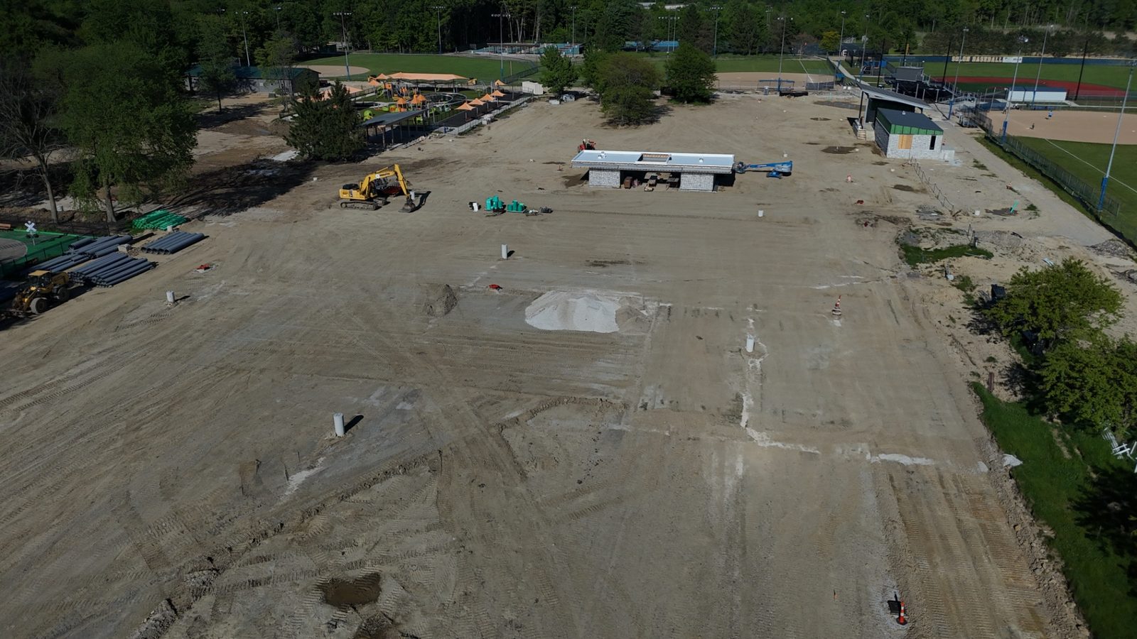
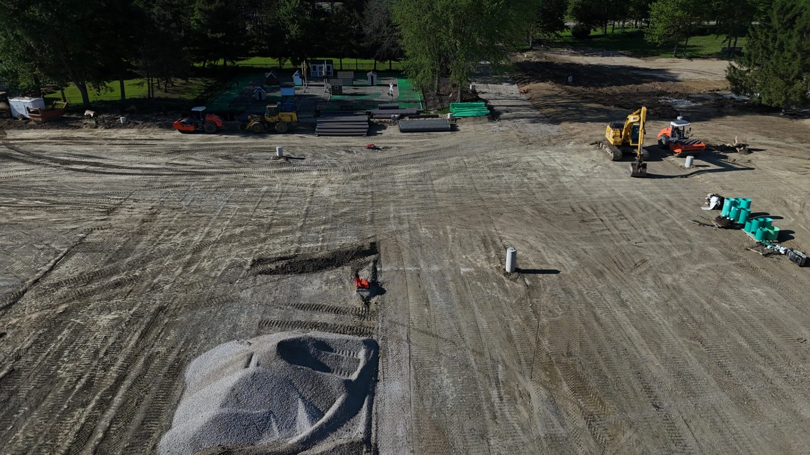
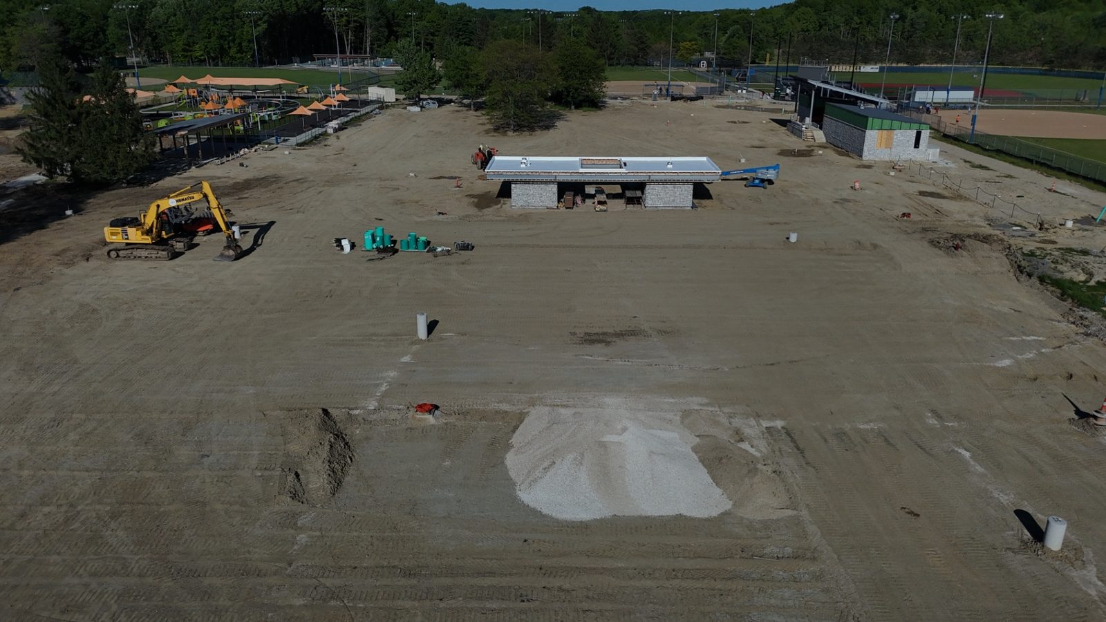
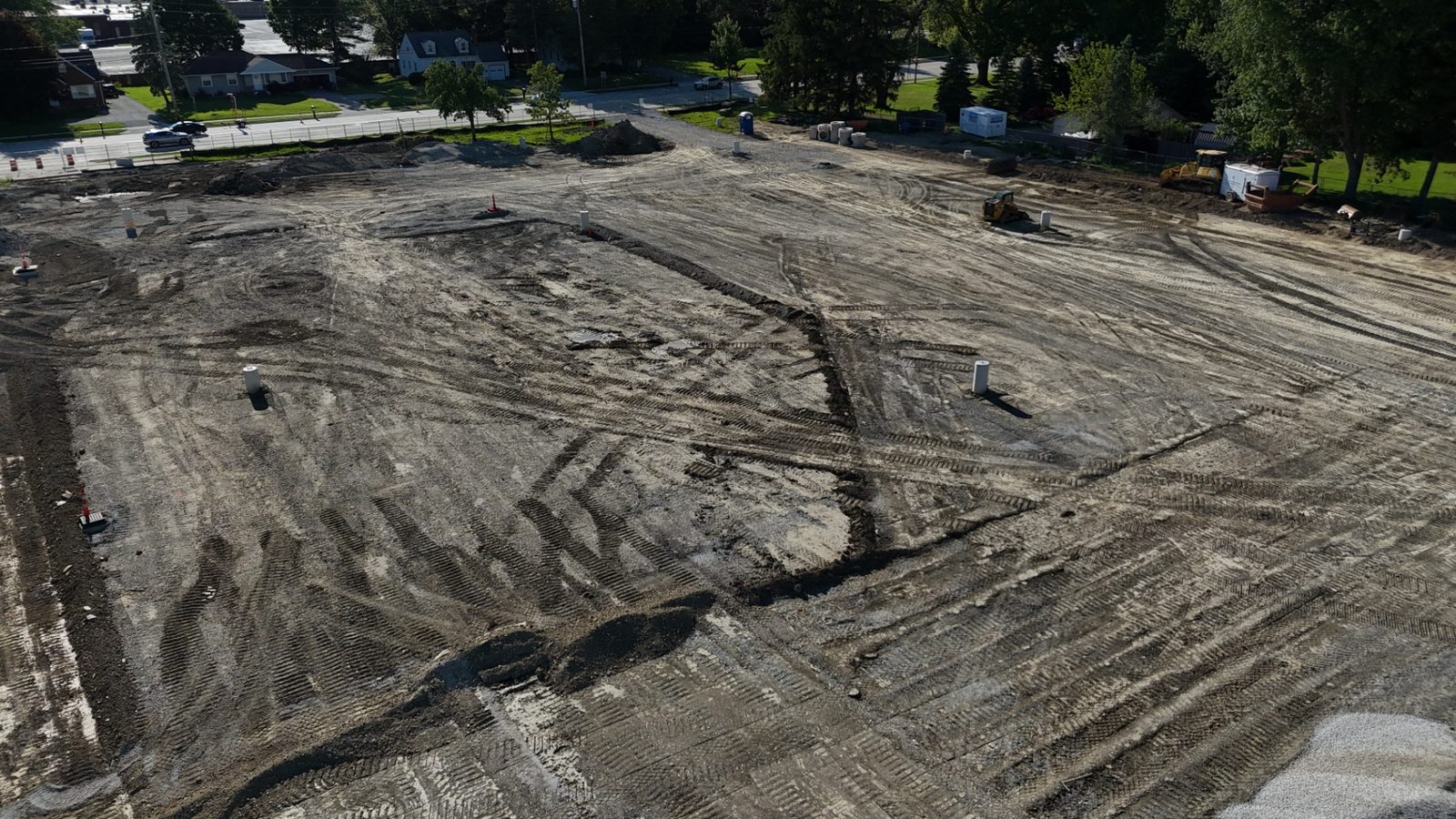
Recent progress visit
Construction progress photos from a recent site.
A sample set of aerial construction progress photos from a single
site visit — site overview, grading and earthwork, structures
going up, and utility work, all captured from repeatable aerial
viewpoints.
Sample aerial progress photos from a recent visit. Each scheduled
visit is delivered as edited stills on a dedicated, shareable
webpage within 24 hours.
Pricing preview
Simple per-visit pricing with multi-visit discounts.
Standard Progress Visit
$299/ visit
One-time or occasional visits
6–11 Scheduled Visits
$269/ visit
Multi-visit discount for ongoing projects
12+ Scheduled Visits
$249/ visit
Best rate for long-running builds
Multi-visit discounts apply to projects booked on a recurring
cadence. Standard rates apply across the Greater Cleveland and
Northeast Ohio area. For projects further afield, additional
travel charges may apply.
Stratum also handles one-off local aerial photo and video
requests across Greater Cleveland and Northeast Ohio. If you
need a clean set of drone photos for a property, business,
project, roof or exterior, or a piece of land, that's a fit.
Local work is welcome and quick to schedule. Reach out with
the address and what you're trying to show, and you'll get a
quote back the same day.
A local aerial media partner for projects, properties, and jobsites.
Stratum Aerial Media is a Cleveland-based aerial photography
practice built for straightforward local work and recurring
construction progress documentation. Show up, fly carefully,
deliver clean images on time, and keep the process easy for
the client.
The approach stays personal on purpose. You talk to the pilot,
get clear communication, and receive usable files without
layers of process or unnecessary complexity. FAA Part 107
certified and fully insured for commercial drone work across
Greater Cleveland and Northeast Ohio.
Frequently asked
Questions we hear most often.
Quick answers to the questions we hear most from builders,
owners, agents, and project teams across Northeast Ohio.
What areas do you serve?
Greater Cleveland and Northeast Ohio, including Cuyahoga,
Lake, Geauga, Summit, Lorain, Medina, and Portage counties.
We're based in Solon, OH. Projects further afield are welcome
— travel charges may apply.
What's your typical turnaround on photos?
Construction progress visits are delivered within 24 hours of
the flight as edited stills on a dedicated, shareable webpage.
Standard photo sets for local and commercial real estate work
are typically delivered within 2–3 business days. Rush
turnaround is available when scheduling allows.
What kinds of projects do you work on most?
Recurring construction progress documentation for builders,
developers, and project teams, plus commercial real estate
aerial media for office, industrial, and retail properties.
We also handle local one-off requests — roofs, exteriors,
land and lots, small business locations, and project sites.
How do I schedule a flight?
Request a quote through the contact section or give us a
call. We'll confirm the location, scope, and a target flight
window — usually within the same week for local work, or on
an ongoing cadence for active jobsites.
What happens if the weather is bad on flight day?
We monitor conditions closely and reschedule whenever wind,
rain, or ceiling won't allow safe, high-quality flights.
Rescheduling is free. For recurring construction visits, we
target the next available window so the project cadence
stays on track.
Can you photograph roofs without anyone going up there?
Yes. We capture high-resolution roof imagery from the air so
owners, property managers, and contractors can review
condition and details without putting anyone on a ladder or
mobilizing a lift. Roof and facade context can be captured
in the same flight as a property shoot.
Do you offer recurring construction progress photography?
Yes — it's our flagship service. We set up weekly,
biweekly, monthly, or milestone-based capture schedules
for active jobsites. Every visit uses repeatable aerial
viewpoints and is delivered as edited stills on a dedicated,
shareable webpage within 24 hours. Multi-visit pricing
applies to projects booked on a recurring cadence.
Are you licensed and insured to fly commercially?
Yes. Flights are conducted by an FAA Part 107 certified
pilot, and we carry commercial drone liability insurance.
Certificates of insurance are available on request — useful
for jobsite onboarding and property manager records.
How does pricing work?
Construction progress visits use simple per-visit pricing
with multi-visit discounts for projects booked on a
recurring cadence — see the pricing preview above. Local
and commercial real estate shoots are quoted by site and
scope. Most quotes go out the same day.
What do I actually receive after a flight?
Edited aerial stills ready to use, organized by date, plus
a dedicated shareable webpage for each progress visit.
Short clips are available when relevant. Stakeholders
review with one link — no logins, no extra software.
Request a quote for construction progress or local aerial work.
Most projects start with a quick call or email. Share the site,
the cadence, and what you're trying to show — you'll get a
quote back fast. Local aerial inquiries are equally welcome.